- i
Human Geography Map
- indianamap.org
- data.baltimorecity.gov
- +12more
Updated Feb 2, 2017 Share
Share Facebook
 Twitter
 EmailClick to copy linkLink copiedCiteEsri (2017). Human Geography Map [Dataset]. https://www.indianamap.org/maps/3582b744bba84668b52a16b0b6942544Dataset updatedFeb 2, 2017Dataset authored and provided byEsriArea coveredDescription
The Human Geography Map (World Edition) web map provides a detailed vector basemap with a monochromatic style and content adjusted to support Human Geography information. Where possible, the map content has been adjusted so that it observes WCAG contrast criteria.This basemap, included in the ArcGIS Living Atlas of the World, uses 3 vector tile layers:Human Geography Label, a label reference layer including cities and communities, countries, administrative units, and at larger scales street names.Human Geography Detail, a detail reference layer including administrative boundaries, roads and highways, and larger bodies of water. This layer is designed to be used with a high degree of transparency so that the detail does not compete with your information. It is set at approximately 50% in this web map, but can be adjusted.Human Geography Base, a simple basemap consisting of land areas in a very light gray only.The vector tile layers in this web map are built using the same data sources used for other Esri Vector Basemaps. For details on data sources contributed by the GIS community, view the map of Community Maps Basemap Contributors. Esri Vector Basemaps are updated monthly.Learn more about this basemap from the cartographic designer in Introducing a Human Geography Basemap.Use this MapThis map is designed to be used as a basemap for overlaying other layers of information or as a stand-alone reference map. You can add layers to this web map and save as your own map. If you like, you can add this web map to a custom basemap gallery for others in your organization to use in creating web maps. If you would like to add this map as a layer in other maps you are creating, you may use the tile layer item referenced in this map.
- a
Human Geography Map
- hub.arcgis.com
- cacgeoportal.com
Updated Apr 1, 2024ShareFacebookTwitterEmailClick to copy linkLink copiedCiteCentral Asia and the Caucasus GeoPortal (2024). Human Geography Map [Dataset]. https://hub.arcgis.com/maps/fab47203217543328f50448dd03d90efDataset updatedApr 1, 2024Dataset authored and provided byCentral Asia and the Caucasus GeoPortalArea coveredDescriptionThis is a subset of World Biomass Image Layer to focus on Central Asia and Caucasus Region. Use this web map to visualize and understand the Biomass for that region. Use image layer for your analysis. Plants play a central role in the carbon cycle by absorbing carbon dioxide from the atmosphere and incorporating it in the structure of the plant. Globally living plants contain 500 billion metric tons of carbon, more than 60 times the amount of carbon released to the atmosphere by humans each year. Understanding the distribution of the carbon stored in living plants, known as biomass, is key to estimating the effects of land use change on the climate.Dataset SummaryThis layer provides access to a 1-km cell-sized raster with data on the density of carbon stored in living plants in metric tons per hectare for the year 2000. It was published by the Oak Ridge National Laboratory Carbon Dioxide Information Analysis Center in 2008.The authors of these data request that they be cited as:Ruesch, Aaron, and Holly K. Gibbs. 2008. New IPCC Tier-1 Global Biomass Carbon Map For the Year 2000. Available online from the Carbon Dioxide Information Analysis Center, Oak Ridge National Laboratory, Oak Ridge, Tennessee.What can you do with this layer?This layer is suitable for both visualization and analysis. It can be used in ArcGIS Online in web maps and applications and can be used in ArcGIS Desktop.This layer has query, identify, and export image services available. This layer is restricted to a maximum area of 16,000 x 16,000 pixels - an area 4,000 kilometers on a side or an area approximately the size of Europe. The Esri Insider Blog provides an introduction to the Ecophysiographic Mapping project.
- i
Human Geography Dark Map
- indianamap.org
- data.baltimorecity.gov
- +10more
Updated May 4, 2017+ more versionsShareFacebookTwitterEmailClick to copy linkLink copiedCiteEsri (2017). Human Geography Dark Map [Dataset]. https://www.indianamap.org/maps/4f2e99ba65e34bb8af49733d9778fb8eDataset updatedMay 4, 2017Dataset authored and provided byEsriArea coveredDescriptionThe Human Geography Dark Map (World Edition) web map provides a detailed world basemap with a dark monochromatic style and content adjusted to support human geography information. Where possible, the map content has been adjusted so that it observes WCAG contrast criteria.This basemap, included in the ArcGIS Living Atlas of the World, uses 3 vector tile layers:Human Geography Dark Label, a label reference layer including cities and communities, countries, administrative units, and at larger scales street names.Human Geography Dark Detail, a detail reference layer including administrative boundaries, roads and highways, and larger bodies of water. This layer is designed to be used with a high degree of transparency so that the detail does not compete with your information. It is set at approximately 50% in this web map, but can be adjusted.Human Geography Dark Base, a simple basemap consisting of land areas in a very dark gray only.The vector tile layers in this web map are built using the same data sources used for other Esri Vector Basemaps. For details on data sources contributed by the GIS community, view the map of Community Maps Basemap Contributors. Esri Vector Basemaps are updated monthly.Learn more about this basemap from the cartographic designer in A Dark Version of the Human Geography Basemap.Use this MapThis map is designed to be used as a basemap for overlaying other layers of information or as a stand-alone reference map. You can add layers to this web map and save as your own map. If you like, you can add this web map to a custom basemap gallery for others in your organization to use in creating web maps. If you would like to add this map as a layer in other maps you are creating, you may use the tile layers referenced in this map.
Human Geography Regions Map Analysis
- library.ncge.org
Updated Jul 27, 2021ShareFacebookTwitterEmailClick to copy linkLink copiedCiteNCGE (2021). Human Geography Regions Map Analysis [Dataset]. https://library.ncge.org/documents/6ef711a51646406e9eff1bd92b61777dDataset updatedJul 27, 2021AuthorsNCGELicenseAttribution-NonCommercial-ShareAlike 4.0 (CC BY-NC-SA 4.0)https://creativecommons.org/licenses/by-nc-sa/4.0/
License information was derived automaticallyDescriptionAuthor: Ann Wurst, consultantGrade/Audience: ap human geographyResource type: activitySubject topic(s): regional geography, maps, human geographyRegion: worldStandards: AP Human Geography CED TOPIC 1.7 Regional Analysis LEARNING OBJECTIVE SPS-1.A Describe different ways that geographers define regions. ESSENTIAL KNOWLEDGE SPS-1.A.1 Regions are defined on the basis of one or more unifying characteristics or on patterns of activity. SPS-1.A.2 Types of regions include formal, functional, and perceptual/vernacular. SPS-1.A.3 Regional boundaries are transitional and often contested and overlapping. SPS-1.A.4 Geographers apply regional analysis at local, national, and global scales.Objectives: Students will be able to describe different ways that geographers define regions. Students wll be able to define Regions on the basis of one ormore unifying characteristics or on patterns of activity. Students will be able to identify the types of regions (formal, functional, and perceptual/vernacular.) Students will understand that Geographers apply regional analysis at local, national, and global scales. Summary: A mapping activity that helps students identify and reflect on the regions used in AP Human Geography classes. Students will be expected to answer some culminating questions after creating their map.
- a
Procedural Human Action Videos - Depth Maps
- academictorrents.com
bittorrentUpdated Jul 14, 2017+ more versionsShareFacebookTwitterEmailClick to copy linkLink copiedCiteCesar Roberto de Souza and Adrien Gaidon and Yohann Cabon and Antonio Manuel Lopez Pena (2017). Procedural Human Action Videos - Depth Maps [Dataset]. https://academictorrents.com/details/eb1ae18213ba0fb97e33ed773eea900a8374efd0bittorrent(124045814703)Available download formatsDataset updatedJul 14, 2017Dataset authored and provided byCesar Roberto de Souza and Adrien Gaidon and Yohann Cabon and Antonio Manuel Lopez PenaLicensehttps://academictorrents.com/nolicensespecifiedhttps://academictorrents.com/nolicensespecified
DescriptionProcedural Human Action Videos (PHAV) ——————————————————- This torrent contains the Procedural Human Action Videos (PHAV) dataset. This version of the dataset contains 39,982 videos that have been generated by a computer. The dataset is made available under the Creative Commons BY-NC-SA (Attribution-NonCommercial-ShareAlike 4.0 International) license. This sub- directory contains the Depth Map data modality of these videos. A human-readable version of the license terms is available at: - The full license terms are available at: - By using PHAV, you agree to abide to the terms of the Creative Commons BY-NC-SA license. If you do not agree with the terms of this license, please contact the dataset authors for other licensing options. For more information, including details
- a
Human Geography Label - Copy
- uscssi.hub.arcgis.com
Updated Apr 24, 2023+ more versionsShareFacebookTwitterEmailClick to copy linkLink copiedCiteSpatial Sciences Institute (2023). Human Geography Label - Copy [Dataset]. https://uscssi.hub.arcgis.com/maps/fe72f66575ff43319620c83a356d978cDataset updatedApr 24, 2023Dataset authored and provided bySpatial Sciences InstituteArea coveredDescriptionThis vector tile layer provides a detailed vector basemap for world labels designed to draw attention to your thematic content. This is similar in content and style to the popular Light Gray Canvas map. This vector tile layer is built using the same data sources used for the Light Gray Canvas and other Esri basemaps. The map includes labels for highways, major roads, minor roads, water features, cities, landmarks, and administrative boundaries. Use this MapThis map is designed to be used as a basemap for overlaying other layers of information or as a stand-alone reference map. You can add layers to this web map and save as your own map. If you like, you can add this web map to a custom basemap gallery for others in your organization to use in creating web maps. If you would like to add this map as a layer in other maps you are creating, you may use the tile layer item referenced in this map.Customize this MapBecause this map includes a vector tile layer, you can customize the map to change its content and symbology. You are able to turn on and off layers, change symbols for layers, switch to alternate local language (in some areas), and refine the treatment of disputed boundaries. For details on how to customize this map, please refer to the Esri Vector Basemap Reference Document (v2) and vector basemap articles on the ArcGIS Online Blog, including Introducing a Human Geography Basemap.Fonts available for use in the style resource directory are under the OFL, Open Font License.This map was designed and created by Andrew Skinner.
Global 100m Terrestrial Human Footprint (HFP-100)
- data.niaid.nih.gov
- datadryad.org
zipUpdated Nov 1, 2023ShareFacebookTwitterEmailClick to copy linkLink copiedCiteJoseph Mazzariello; Francis Gassert (2023). Global 100m Terrestrial Human Footprint (HFP-100) [Dataset]. http://doi.org/10.5061/dryad.ttdz08m1fzipAvailable download formatsUnique identifierhttps://doi.org/10.5061/dryad.ttdz08m1fDataset updatedNov 1, 2023Dataset provided byVizzuality (Spain)
Impact Observatory, Inc.AuthorsJoseph Mazzariello; Francis GassertLicensehttps://spdx.org/licenses/CC0-1.0.htmlhttps://spdx.org/licenses/CC0-1.0.html
DescriptionMaps depicting the intensity of human pressure on the environment have become a critical tool for spatial planning and management, monitoring the extent of human influence across Earth, and identifying critical remaining intact habitat. Yet, these maps are often years out of date by the time they are available to scientists and policy-makers. Here we provide an updated Human Footprint methodology to run on an annual basis to monitor changing anthropogenic pressures. Software and methods are parameterized to enable regular updates in the future. In addition, we release a 100-meter global dataset for the years 2015–2019 and 2020 based on land use, population, infrastructure, and accessibility data. Results show high levels of agreement in validation against expert-interpreted satellite imagery and improved performance compared to previous iterations of similar datasets. These maps are directly relevant to measuring progress towards national and international targets related to biodiversity conservation and sustainable development. Methods This dataset was created by combining data on human pressures across the period 2015 to 2019 and for 2020 to map: 1) Land cover change (built environments, crop lands, and pasture lands), 2) population density, 3) electric infrastructure, 4) roadways, 5) railways, and 6) navigable waterways. Each pressure layer is assigned a score relative to its level of human pressure, then computed into a standardized scale of 0–50 as the sum of all pressure layers. Pressures are not mutually exclusive, rather the co-occurrence of pressures is intended to identify the greatest levels of human impact. The majority of layers cover the complete time period of 2015–2020, however, pressures from pasture, roads, and railways are treated as static in the Human Footprint maps due to limitations in the input datasets. Scripts used to produce this data are available at: https://gitlab.com/impactobservatory/dwi-humanfootprint Overall methodology is based on the following: --B. A. Williams, O. Venter, J. R. Allan, S. C. Atkinson, J. A. Rehbein, M. Ward, M. Di Marco, H. S. Grantham, J. Ervin, S. J. Goetz, A. J. Hansen, P. Jantz, R. Pillay, S. Rodríguez-Buriticá, C. Supples, A. L. S. Virnig, J. E. M. Watson, Change in Terrestrial Human Footprint Drives Continued Loss of Intact Ecosystems. One Earth. 3, 371–382 (2020). --E. W. Sanderson, M. Jaiteh, M. A. Levy, K. H. Redford, A. V. Wannebo, G. Woolmer, The Human Footprint and the Last of the Wild: The human footprint is a global map of human influence on the land surface, which suggests that human beings are stewards of nature, whether we like it or not. BioScience. 52, 891–904 (2002). --O. Venter, E. W. Sanderson, A. Magrach, J. R. Allan, J. Beher, K. R. Jones, H. P. Possingham, W. F. Laurance, P. Wood, B. M. Fekete, M. A. Levy, J. E. M. Watson, Global terrestrial Human Footprint maps for 1993 and 2009. Sci. Data. 3, 160067 (2016). Please see the following for more detail: Gassert F, Venter O, Watson JEM, Brumby SP, Mazzariello JC, Atkinson SC and Hyde S, An operational approach to near real-time global high-resolution mapping of the terrestrial human footprint. Front. Remote Sens. 4:1130896. doi: 10.3389/frsen.2023.1130896 (2023)
Human Geography Dark Label
- cacgeoportal.com
- hub.arcgis.com
Updated Nov 3, 2017+ more versionsShareFacebookTwitterEmailClick to copy linkLink copiedCiteEsri (2017). Human Geography Dark Label [Dataset]. https://www.cacgeoportal.com/maps/4a3922d6d15f405d8c2b7a448a7fbad2Dataset updatedNov 3, 2017Area coveredDescriptionThis vector tile layer presents the Human Geography Dark Label style (World Edition) and provides a detailed vector basemap for the world with a dark monochromatic style and content adjusted to support Human Geography information. The map includes labels for highways, major roads, minor roads, railways, water features, building footprints, and administrative boundaries. It is designed to be used with the Human Geography Dark Detail and Human Geography Dark Base layers. Learn more about this basemap's design from the cartographic designer in this blog. This vector tile layer provides unique capabilities for customization, high-resolution display, and use in mobile devices.This vector tile layer is built using the same data sources used for other Esri Vector Basemaps. For details on data sources contributed by the GIS community, view the map of Community Maps Basemap Contributors. Esri Vector Basemaps are updated monthly.This layer is used in the Human Geography Dark Map web map included in ArcGIS Living Atlas of the World.See the Vector Basemaps group for other vector tile layers. Customize this StyleLearn more about customizing this vector basemap style using the Vector Tile Style Editor. Additional details are available in ArcGIS Online Blogs and the Esri Vector Basemaps Reference Document.
- n
Thinking Geographically - Human-Environment Interaction (1.5) 2020
- library.ncge.org
Updated Apr 23, 2021ShareFacebookTwitterEmailClick to copy linkLink copiedCiteNCGE (2021). Thinking Geographically - Human-Environment Interaction (1.5) 2020 [Dataset]. https://library.ncge.org/documents/475fb5b8fff34ec28efdf5453f28da08Dataset updatedApr 23, 2021Dataset authored and provided byNCGELicenseAttribution-NonCommercial-ShareAlike 4.0 (CC BY-NC-SA 4.0)https://creativecommons.org/licenses/by-nc-sa/4.0/
License information was derived automaticallyDescription3-for-3 activities designed to support Advanced Placement Human Geography.
Human Geography Map
- cesna-lb-terreliban.hub.arcgis.com
- national-government-solution-playbook-tiger.hub.arcgis.com
- +1more
Updated Jun 30, 2020ShareFacebookTwitterEmailClick to copy linkLink copiedCiteesri_en (2020). Human Geography Map [Dataset]. https://cesna-lb-terreliban.hub.arcgis.com/maps/9b5ac84489b748c5964105c08412daa0Dataset updatedJun 30, 2020Authorsesri_enArea coveredDescriptionThis map consists of vector tile layers that form a detailed basemap for the world, featuring a monochromatic style with content adjusted to support Human Geography information. The map is intended to support the ArcGIS Online basemap gallery. For more details on the map, please visit the Human Geography Map.
- d
Data from: Global terrestrial Human Footprint maps for 1993 and 2009
- datadryad.org
- data.niaid.nih.gov
- +2more
zipUpdated Nov 17, 2016ShareFacebookTwitterEmailClick to copy linkLink copiedCiteOscar Venter; Eric W. Sanderson; Ainhoa Magrach; James R. Allan; Jutta Beher; Kendall R. Jones; Hugh P. Possingham; William F. Laurance; Peter Wood; Balázs M. Fekete; Marc A. Levy; James E.M. Watson (2016). Global terrestrial Human Footprint maps for 1993 and 2009 [Dataset]. http://doi.org/10.5061/dryad.052q5zipAvailable download formatsUnique identifierhttps://doi.org/10.5061/dryad.052q5Dataset updatedNov 17, 2016Dataset provided byDryadAuthorsOscar Venter; Eric W. Sanderson; Ainhoa Magrach; James R. Allan; Jutta Beher; Kendall R. Jones; Hugh P. Possingham; William F. Laurance; Peter Wood; Balázs M. Fekete; Marc A. Levy; James E.M. WatsonTime period covered2016Area coveredGlobal terrestrialDescriptionHuman Footprint maps7-zip file including the Human Footprint maps for 1993 and 2009, individual pressures, and validation data. A full data description is included as a word file in the download.HumanFootprintv2.7z
Data from: Tox21BodyMap: A webtool to map chemical effects on the human body...
- catalog.data.gov
Updated Nov 12, 2020ShareFacebookTwitterEmailClick to copy linkLink copiedCiteU.S. EPA Office of Research and Development (ORD) (2020). Tox21BodyMap: A webtool to map chemical effects on the human body [Dataset]. https://catalog.data.gov/dataset/tox21bodymap-a-webtool-to-map-chemical-effects-on-the-human-bodyDataset updatedNov 12, 2020DescriptionThis manuscript describes development of a novel tool called Tox21BodyMap. This tool is designed to map biological assay data onto organs of the human body, facilitating predictions between chemical exposure and apical effects. Tox21BodyMap maps chemical effects to biological target tissues uses tissue-specific gene expression and high throughput screening data. High throughput screening sources includes ToxCast and Tox21. Tox21BodyMap is a freely available, online tool. This dataset is associated with the following publication: Borrel, A., S. Auerbach, K. Houck, and N. Kleinstreuer. Tox21BodyMap: A webtool to map chemical effects on the human body. NUCLEIC ACIDS RESEARCH. Oxford University Press, Cary, NC, USA, 48(W1): W472-W476, (2020).
- e
Data from: A draft map of the human proteome
- ebi.ac.uk
- data.niaid.nih.gov
ShareFacebookTwitterEmailClick to copy linkLink copiedCiteAkhilesh Pandey, A draft map of the human proteome [Dataset]. https://www.ebi.ac.uk/pride/archive/projects/PXD000561AuthorsAkhilesh PandeyVariables measuredProteomicsDescriptionThe availability of human genome sequence has transformed biomedical research over the past decade. However, an equivalent map for the human proteome with direct measurements of proteins and peptides does not exist yet. Here, we report a draft map of the human proteome based on high resolution Fourier transform mass spectrometry-based proteomics technology. In-depth proteomic profiling of 30 histologically normal human samples including 17 adult tissues, 7 fetal tissues and 6 purified primary hematopoietic cells resulted in identification of proteins encoded by greater than 17,000 genes accounting for ~84% of the total annotated protein-coding genes in humans. This large human proteome catalog (available as an interactive web-based resource at http://www.humanproteomemap.org) will complement available human genome and transcriptome data to accelerate biomedical research in health and disease. The authors request that those considering use of this dataset for commercial purposes contact pandey@jhmi.edu.
- u
Human Footprint 2009 (Terrestrial)
- datacore-gn.unepgrid.ch
Updated Oct 19, 2018+ more versionsShareFacebookTwitterEmailClick to copy linkLink copiedCite(2018). Human Footprint 2009 (Terrestrial) [Dataset]. https://datacore-gn.unepgrid.ch/geonetwork/srv/api/records/de703488-f155-4742-be36-f8b6ec0419c6ogc:wms-1.3.0-http-get-map, www:link-1.0-http--linkAvailable download formatsDataset updatedOct 19, 2018LicenseCC0 1.0 Universal Public Domain Dedicationhttps://creativecommons.org/publicdomain/zero/1.0/
License information was derived automaticallyTime period coveredJan 1, 2009 - Dec 31, 2009Area coveredDescriptionThe Human Footprint (HFP) provides a measure of the direct and indirect human pressures on the environment globally in years 1993 and 2009. It is derived from remotely-sensed and bottom-up survey information compiled on eight measured variables. This represents not only the most current information of its type, but also the first temporally-consistent set of Human Footprint maps. Data on human pressures were acquired or developed for: 1) built environments, 2) population density, 3) electric infrastructure, 4) crop lands, 5) pasture lands, 6) roads, 7) railways, and 8) navigable waterways. Pressures were then overlaid to create the standardized Human Footprint maps for all non-Antarctic land areas. The Human Footprint maps find a range of uses as proxies for human disturbance of natural systems and can provide an increased understanding of the human pressures that drive macro-ecological patterns, as well as for tracking environmental change and informing conservation science and application. HFP values range from 0 (no human impact) to 50 (heavily human impacted).
See: Venter, O. et al., 2016. Sixteen years of change in the global terrestrial human footprint and implications for biodiversity conservation. Nature Communications, 7, pp.1–11.
Data can also be downloaded from ""https://datadryad.org/resource/doi:10.5061/dryad.052q5"">Dryad. - n
Amanda Bay Satellite Image Map 1:100 000
- cmr.earthdata.nasa.gov
- data.aad.gov.au
- +3more
cfmUpdated Apr 19, 2018+ more versionsShareFacebookTwitterEmailClick to copy linkLink copiedCite(2018). Amanda Bay Satellite Image Map 1:100 000 [Dataset]. https://cmr.earthdata.nasa.gov/search/concepts/C1214311750-AU_AADC.htmlcfmAvailable download formatsDataset updatedApr 19, 2018Time period coveredDec 1, 1991 - Dec 31, 1991Area coveredDescriptionSatellite image map of Amanda Bay, Antarctica. This map was produced for the Australian Antarctic Division by AUSLIG (now Geoscience Australia) Commercial, in Australia, in 1991. The map is at a scale of 1:100 000, and was produced from Landsat 4 TM imagery (124-108, 124-109). It is projected on a Transverse Mercator projection, and shows traverses/routes/foot track charts, glaciers/ice shelves, penguin colonies, stations/bases, runways/helipads, and gives some historical text information. The map has both geographical and UTM co-ordinates.
Structural ensembles of human tRNAs based on cryoEM maps
- figshare.com
txtUpdated Dec 22, 2023ShareFacebookTwitterEmailClick to copy linkLink copiedCiteSunandan Mukherjee (2023). Structural ensembles of human tRNAs based on cryoEM maps [Dataset]. http://doi.org/10.6084/m9.figshare.24871854.v1txtAvailable download formatsUnique identifierhttps://doi.org/10.6084/m9.figshare.24871854.v1Dataset updatedDec 22, 2023AuthorsSunandan MukherjeeLicenseAttribution 4.0 (CC BY 4.0)https://creativecommons.org/licenses/by/4.0/
License information was derived automaticallyDescriptionStructures of tRNA models dynamically fitted to map obtained from the cryo-electron microscope experiments. Each file consists of an ensemble of 10 atomic models of unmodified and Ψ13- and Ψ55-modified human tRNAGlnUUG, tRNAGlyCCC, tRNAGluUUC and tRNAAspCUG. It also consists of ensemble of Ψ13-, Ψ39- and Ψ55-modified human tRNAGlyCCC.
MOOD Maps of Google community mobility change during the COVID-19 outbreak
- figshare.com
xlsxUpdated Oct 28, 2022ShareFacebookTwitterEmailClick to copy linkLink copiedCiteWilliam Wint; Neil Alexander (2022). MOOD Maps of Google community mobility change during the COVID-19 outbreak [Dataset]. http://doi.org/10.6084/m9.figshare.12130980.v155xlsxAvailable download formatsUnique identifierhttps://doi.org/10.6084/m9.figshare.12130980.v155Dataset updatedOct 28, 2022AuthorsWilliam Wint; Neil AlexanderLicenseAttribution 4.0 (CC BY 4.0)https://creativecommons.org/licenses/by/4.0/
License information was derived automaticallyDescriptionThe MOOD project (MOnitoring Outbreak events for Disease surveillance in a data science context. H2020) has geo-referenced the data Google has published as a series of PDF files presenting reports on national and subnational human mobility levels relative to a baseline data of late January 2020. The details and the PDF files can be found at https://www.google.com/covid19/mobility/.More detail on these files can be found at https://www.moodspatialdata.com/humanmobilityforcovid19 The first set of data were released on April 2 2020 and have been revised weekly since then. The maps now utilise the CSV data released by Google. Please note that the maps figures use a mean of the previous three days, while the Google PDFs use a single days data so there will be differences between values in our maps when compare to the Google PDFs.The authors have extracted the majority of these data into a series of excel spreadsheets. Each worksheet provides the data for % change in numbers of records at various types of location categories illustrated by: retail and recreation, grocery and pharmacy, parks and beaches, transit stations, workplaces and residential (columns f to K). A second set of columns calculates the difference of each value from the mean values for each category (columns L to P) Columns A to E contain geographical details. Column Q contains the names used to link to a mapping file.There are separate worksheets for the date of the data from each dated release (e.g. 2903, 0504 etc.) and separate worksheets calculating the changes between specific dates.A second spreadsheet has been added calculating the 3 day moving mean of each day from the 15th of February. Each day is referenced by the Gregorian calendar day count. So day 48 = Feb 17th.The maps (for EU & Global) display these data. We provide 600 dpi jpegs of the Global (“WD”) and European (“EU”) mapped values at the latest date available, for each of the mobility categories: retail and recreation (“retrec”) , grocery and pharmacy (“grocphar”) , parks (“parks”) , transit stations (“transit”), residential (“resid”) and workplaces (“work”). We also provide maps of the changes from the previous week (“ch”).All data extracting and subsequent processing have been carried out by ERGO (Environmental Research Group Oxford, c/o Dept Zoology, University of Oxford) on behalf of the MOOD H2020 project. Data will be periodically updated. Additional maps can be obtained on request to the authors.
- N
BrainPedia - Individual maps of first Human Connectome project release:...
- neurovault.org
niftiUpdated Oct 26, 2016+ more versionsShareFacebookTwitterEmailClick to copy linkLink copiedCite(2016). BrainPedia - Individual maps of first Human Connectome project release: punish_vs_baseline [Dataset]. http://identifiers.org/neurovault.image:26566niftiAvailable download formatsUnique identifierhttps://identifiers.org/neurovault.image:26566Dataset updatedOct 26, 2016LicenseCC0 1.0 Universal Public Domain Dedicationhttps://creativecommons.org/publicdomain/zero/1.0/
License information was derived automaticallyDescription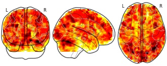
Collection description
Individual maps from HCP Q1 release (BrainPedia analysis)
Subject species
homo sapiens
Modality
fMRI-BOLD
Analysis level
single-subject
Cognitive paradigm (task)
gambling fMRI task paradigm
Map type
Z
- w
State Of Wyoming Maps
- data.wu.ac.at
pdfUpdated Dec 24, 2015+ more versionsShareFacebookTwitterEmailClick to copy linkLink copiedCite(2015). State Of Wyoming Maps [Dataset]. https://data.wu.ac.at/schema/geothermaldata_org/ZWVhNDg0MmYtZDRlYS00OGU4LWI4ZDEtYzA0M2JjNjgyZDQwpdfAvailable download formatsDataset updatedDec 24, 2015Area covered80f41218322ef711830743e2e3467a1e43d0b6a8DescriptionState Of Wyoming Maps
- e
3D cytoarchitectonic map of the human mesial piriform region of the BigBrain...
- search.kg.ebrains.eu
Updated Apr 8, 2024ShareFacebookTwitterEmailClick to copy linkLink copiedCiteChristian Schiffer; Olga Kedo; Katrin Amunts; Timo Dickscheid (2024). 3D cytoarchitectonic map of the human mesial piriform region of the BigBrain [Dataset]. http://doi.org/10.25493/NQWJ-2EMUnique identifierhttps://doi.org/10.25493/NQWJ-2EMDataset updatedApr 8, 2024AuthorsChristian Schiffer; Olga Kedo; Katrin Amunts; Timo DickscheidDescriptionThis dataset contains cytoarchitectonic maps of four areas of the mesial piriform region in the BigBrain dataset. The maps are based on reference delineations in serial histological sections of the BigBrain at 1 micron resolution in-plane, with a distance of sections typically not lower than 300 micrometers. The 3D cytoarchitectonic maps were created in two different approaches: (1) As first version, a 3D map of the area was created by interpolation of the respective reference delineations. (2) As a more advanced version, a 3D map was created using deep convolutional neural networks trained on the respective reference delineations. As a result, the latter version also includes delineations of the area in the sections in-between reference delineations. The 3D maps were transformed to the 3D reconstructed BigBrain space and are integrated into the Julich-Brain Cytoarchitectonic Atlas.
FacebookTwitterThe Human Geography Map (World Edition) web map provides a detailed vector basemap with a monochromatic style and content adjusted to support Human Geography information. Where possible, the map content has been adjusted so that it observes WCAG contrast criteria.This basemap, included in the ArcGIS Living Atlas of the World, uses 3 vector tile layers:Human Geography Label, a label reference layer including cities and communities, countries, administrative units, and at larger scales street names.Human Geography Detail, a detail reference layer including administrative boundaries, roads and highways, and larger bodies of water. This layer is designed to be used with a high degree of transparency so that the detail does not compete with your information. It is set at approximately 50% in this web map, but can be adjusted.Human Geography Base, a simple basemap consisting of land areas in a very light gray only.The vector tile layers in this web map are built using the same data sources used for other Esri Vector Basemaps. For details on data sources contributed by the GIS community, view the map of Community Maps Basemap Contributors. Esri Vector Basemaps are updated monthly.Learn more about this basemap from the cartographic designer in Introducing a Human Geography Basemap.Use this MapThis map is designed to be used as a basemap for overlaying other layers of information or as a stand-alone reference map. You can add layers to this web map and save as your own map. If you like, you can add this web map to a custom basemap gallery for others in your organization to use in creating web maps. If you would like to add this map as a layer in other maps you are creating, you may use the tile layer item referenced in this map.