- d
Historical Map & Chart Collection of NOAA's Nautical Charts, Hydrographic...
- catalog.data.gov
- s.cnmilf.com
- +1more
Updated Apr 13, 2025 Share
Share Facebook
 Twitter
 EmailClick to copy linkLink copiedCite(Point of Contact, Custodian) (2025). Historical Map & Chart Collection of NOAA's Nautical Charts, Hydrographic Surveys, Topographic Surveys, Geodetic Surveys, City Plans, and Civil War Battle Maps Starting from the mid 1700's [Dataset]. https://catalog.data.gov/dataset/historical-map-chart-collection-of-noaas-nautical-charts-hydrographic-surveys-topographic-surve1Dataset updatedApr 13, 2025Dataset provided by(Point of Contact, Custodian)Description
The Historical Map and Chart Collection of the Office of Coast Survey contains over 35000 historical maps and charts from the mid 1700s up through the 2020s, including the final cancelled editions of NOAA's raster charts. These images are available for viewing or download through the image catalog at https://historicalcharts.noaa.gov/. The Collection includes some of the nation's earliest nautical charts, hydrographic surveys, topographic surveys, bathymetric maps, annual reports, coast pilots, geodetic surveys, city plans, and Civil War battle maps. The Collection is a rich primary historical archive and a testament to the artistry of copper plate engraving technology of the nineteenth and twentieth centuries. Notable offerings include maps of Vancouver's explorations, the "Wilkes Atlas" of the U.S. Whistler's Anacapa Island chart, an extensive Civil War collection, a large scale topographic series of Washington, D.C., city plans, the reengraving of the famous 1792 L'Enfant and Ellicott plan for Washington D.C., and many artistic perspective sketches that were once an integral part of hydrographic surveys and published charts.
- w
Maps and Charts
- data.wu.ac.at
- researchdata.edu.au
dataUpdated Oct 27, 2016+ more versionsShareFacebookTwitterEmailClick to copy linkLink copiedCiteSouth Australian Governments (2016). Maps and Charts [Dataset]. https://data.wu.ac.at/schema/data_gov_au/NWQ1ZGNhZjEtNDRlOS00NGQxLWFlYzctY2EwZmUxNTA5YTMwdataAvailable download formatsDataset updatedOct 27, 2016Dataset provided bySouth Australian GovernmentsLicenseAttribution 3.0 (CC BY 3.0)https://creativecommons.org/licenses/by/3.0/
License information was derived automaticallyDescriptionThis dataset contains images of more than 1100 selected maps and charts with South Australian coverage.
Use in conjunction with the Flickr API https://www.flickr.com/services/api/
- T
Namibia Imports of maps, hydrographic or similar charts (printed) from Spain...
- tradingeconomics.com
csv, excel, json, xmlUpdated Jun 4, 2024ShareFacebookTwitterEmailClick to copy linkLink copiedCiteTRADING ECONOMICS (2024). Namibia Imports of maps, hydrographic or similar charts (printed) from Spain [Dataset]. https://tradingeconomics.com/namibia/imports/spain/maps-hydrographic-charts-atlasescsv, excel, json, xmlAvailable download formatsDataset updatedJun 4, 2024Dataset authored and provided byTRADING ECONOMICSLicenseAttribution 4.0 (CC BY 4.0)https://creativecommons.org/licenses/by/4.0/
License information was derived automaticallyTime period coveredJan 1, 1990 - Dec 31, 2025Area coveredNamibiaDescriptionNamibia Imports of maps, hydrographic or similar charts (printed) from Spain was US$1.11 Thousand during 2019, according to the United Nations COMTRADE database on international trade. Namibia Imports of maps, hydrographic or similar charts (printed) from Spain - data, historical chart and statistics - was last updated on November of 2025.
NOAA Chart Display Map Service
- prep-response-portal-napsg.hub.arcgis.com
- noaa.hub.arcgis.com
- +1more
Updated Mar 7, 2022+ more versionsShareFacebookTwitterEmailClick to copy linkLink copiedCiteNOAA GeoPlatform (2022). NOAA Chart Display Map Service [Dataset]. https://prep-response-portal-napsg.hub.arcgis.com/maps/e9ca225657354ce4a8a64a1c1b0b60baDataset updatedMar 7, 2022AuthorsNOAA GeoPlatformArea coveredDescriptionThe NOAA Chart Display Service (NCDS) renders NOAA electronic navigational chart (NOAA ENC®) data with “traditional paper chart” symbology in online and offline applications for which a basemap of nautical chart data is desired, including GIS, web-based, and mobile mapping applications.The service uses symbols, labels, and color schemes familiar to those who have used NOAA paper nautical charts or the NOAA Custom Chart application. NCDS is available as Esri REST Map Service, OGC Web Map Service (WMS), and MBTiles formats.The ENC data in the service are updated weekly and include all of the latest Notice to Mariners corrections.
- N
Individual Brain Charting dataset extension, second release of...
- neurovault.org
niftiUpdated Feb 14, 2020+ more versionsShareFacebookTwitterEmailClick to copy linkLink copiedCite(2020). Individual Brain Charting dataset extension, second release of high-resolution fMRI data for cognitive mapping: sub-01_ses-19_task-preference_paintings_dir-ap_painting_linear [Dataset]. http://identifiers.org/neurovault.image:360769niftiAvailable download formatsUnique identifierhttps://identifiers.org/neurovault.image:360769Dataset updatedFeb 14, 2020LicenseCC0 1.0 Universal Public Domain Dedicationhttps://creativecommons.org/publicdomain/zero/1.0/
License information was derived automaticallyDescription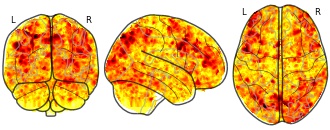
Collection description
The individual Brain Charting (IBC) Project is using high resolution fMRI to map 13 subjects that undergo a large number of tasks: the HCP tasks, the so-called ARCHI tasks, a specific language task, video watching, low-level visual stimulation etc. The native resolution of the data is 1.5mm isotropic. Their main value lies in the large number of contrasts probed, the level of detail and the high SNR per subject. This dataset is meant to provide the basis of a functional brain atlas. We upload here smoothed individual SPMs. The uploaded maps comprise session-specific and fixed effects across maps acquired with AP and PA phase encoding directions.
Note that Neurovault collection #4438 is a subset of that one. In the present collections, some details have been fixed, including mroe accurate and unique file naming.
Subject species
homo sapiens
Modality
fMRI-BOLD
Analysis level
single-subject
Cognitive paradigm (task)
pleasantness rating task
Map type
Z
- N
Individual Brain Charting dataset extension, second release of...
- neurovault.org
niftiUpdated Feb 14, 2020+ more versionsShareFacebookTwitterEmailClick to copy linkLink copiedCite(2020). Individual Brain Charting dataset extension, second release of high-resolution fMRI data for cognitive mapping: sub-06_ses-04_task-archi_emotional_dir-pa_face_trusty-gender [Dataset]. http://identifiers.org/neurovault.image:365288niftiAvailable download formatsUnique identifierhttps://identifiers.org/neurovault.image:365288Dataset updatedFeb 14, 2020LicenseCC0 1.0 Universal Public Domain Dedicationhttps://creativecommons.org/publicdomain/zero/1.0/
License information was derived automaticallyDescription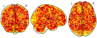
Collection description
The individual Brain Charting (IBC) Project is using high resolution fMRI to map 13 subjects that undergo a large number of tasks: the HCP tasks, the so-called ARCHI tasks, a specific language task, video watching, low-level visual stimulation etc. The native resolution of the data is 1.5mm isotropic. Their main value lies in the large number of contrasts probed, the level of detail and the high SNR per subject. This dataset is meant to provide the basis of a functional brain atlas. We upload here smoothed individual SPMs. The uploaded maps comprise session-specific and fixed effects across maps acquired with AP and PA phase encoding directions.
Note that Neurovault collection #4438 is a subset of that one. In the present collections, some details have been fixed, including mroe accurate and unique file naming.
Subject species
homo sapiens
Modality
fMRI-BOLD
Analysis level
single-subject
Cognitive paradigm (task)
emotional localizer fMRI task paradigm
Map type
Z
Map Product: Nautical Maps/Charts
- noaa.hub.arcgis.com
Updated Aug 30, 2022ShareFacebookTwitterEmailClick to copy linkLink copiedCiteNOAA GeoPlatform (2022). Map Product: Nautical Maps/Charts [Dataset]. https://noaa.hub.arcgis.com/maps/56dbe60e9cb845e8bb6f1816d0ad565eDataset updatedAug 30, 2022AuthorsNOAA GeoPlatformArea coveredDescriptionThis web map depicts the results of the 2021 Alaska Coastal & Ocean Mapping Prioritization Survey where respondents noted they have a priority requirement for nautical charts or mapping updates. The survey question asked what Map Product they need for a given cell, and this map shows all cells where the answer was equal to Nautical Maps/Charts. Used in the experience builder here: https://experience.arcgis.com/experience/0b3e823a5c8b42dcbbd1b49f91d4c07aHosted on the Alaska Coastal Mapping Strategy Hub Site: https://alaska-coastal-mapping-strategy-noaa.hub.arcgis.com/
- T
Netherlands Imports of maps, hydrographic or similar charts (printed) from...
- tradingeconomics.com
csv, excel, json, xmlUpdated May 18, 2024ShareFacebookTwitterEmailClick to copy linkLink copiedCiteTRADING ECONOMICS (2024). Netherlands Imports of maps, hydrographic or similar charts (printed) from Bolivia [Dataset]. https://tradingeconomics.com/netherlands/imports/bolivia/maps-hydrographic-charts-atlasesjson, xml, csv, excelAvailable download formatsDataset updatedMay 18, 2024Dataset authored and provided byTRADING ECONOMICSLicenseAttribution 4.0 (CC BY 4.0)https://creativecommons.org/licenses/by/4.0/
License information was derived automaticallyTime period coveredJan 1, 1990 - Dec 31, 2025Area coveredNetherlandsDescriptionNetherlands Imports of maps, hydrographic or similar charts (printed) from Bolivia was US$1 during 2017, according to the United Nations COMTRADE database on international trade. Netherlands Imports of maps, hydrographic or similar charts (printed) from Bolivia - data, historical chart and statistics - was last updated on December of 2025.
- N
Individual Brain Charting dataset extension, second release of...
- neurovault.org
niftiUpdated Feb 14, 2020+ more versionsShareFacebookTwitterEmailClick to copy linkLink copiedCite(2020). Individual Brain Charting dataset extension, second release of high-resolution fMRI data for cognitive mapping: sub-01_ses-07_task-archi_emotional_dir-pa_expression_intention-control [Dataset]. http://identifiers.org/neurovault.image:364131niftiAvailable download formatsUnique identifierhttps://identifiers.org/neurovault.image:364131Dataset updatedFeb 14, 2020LicenseCC0 1.0 Universal Public Domain Dedicationhttps://creativecommons.org/publicdomain/zero/1.0/
License information was derived automaticallyDescription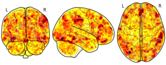
Collection description
The individual Brain Charting (IBC) Project is using high resolution fMRI to map 13 subjects that undergo a large number of tasks: the HCP tasks, the so-called ARCHI tasks, a specific language task, video watching, low-level visual stimulation etc. The native resolution of the data is 1.5mm isotropic. Their main value lies in the large number of contrasts probed, the level of detail and the high SNR per subject. This dataset is meant to provide the basis of a functional brain atlas. We upload here smoothed individual SPMs. The uploaded maps comprise session-specific and fixed effects across maps acquired with AP and PA phase encoding directions.
Note that Neurovault collection #4438 is a subset of that one. In the present collections, some details have been fixed, including mroe accurate and unique file naming.
Subject species
homo sapiens
Modality
fMRI-BOLD
Analysis level
single-subject
Cognitive paradigm (task)
emotional localizer fMRI task paradigm
Map type
Z
MAP: Training Data
- kaggle.com
zipUpdated Oct 16, 2025ShareFacebookTwitterEmailClick to copy linkLink copiedCiteKawsar Hossain (2025). MAP: Training Data [Dataset]. https://www.kaggle.com/datasets/kawchar85/map-training-datazip(2790557 bytes)Available download formatsDataset updatedOct 16, 2025AuthorsKawsar HossainLicenseApache License, v2.0https://www.apache.org/licenses/LICENSE-2.0
License information was derived automaticallyDescriptionDataset
This dataset was created by Kawsar Hossain
Released under Apache 2.0
Contents
- N
Individual Brain Charting dataset extension, second release of...
- neurovault.org
niftiUpdated Feb 14, 2020+ more versionsShareFacebookTwitterEmailClick to copy linkLink copiedCite(2020). Individual Brain Charting dataset extension, second release of high-resolution fMRI data for cognitive mapping: sub-15_ses-15_task-mtt_sn_dir-pa_run-02_sn_time-space_event [Dataset]. http://identifiers.org/neurovault.image:367935niftiAvailable download formatsUnique identifierhttps://identifiers.org/neurovault.image:367935Dataset updatedFeb 14, 2020LicenseCC0 1.0 Universal Public Domain Dedicationhttps://creativecommons.org/publicdomain/zero/1.0/
License information was derived automaticallyDescription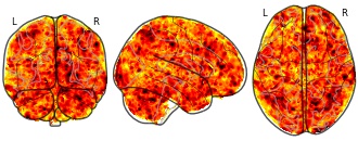
Collection description
The individual Brain Charting (IBC) Project is using high resolution fMRI to map 13 subjects that undergo a large number of tasks: the HCP tasks, the so-called ARCHI tasks, a specific language task, video watching, low-level visual stimulation etc. The native resolution of the data is 1.5mm isotropic. Their main value lies in the large number of contrasts probed, the level of detail and the high SNR per subject. This dataset is meant to provide the basis of a functional brain atlas. We upload here smoothed individual SPMs. The uploaded maps comprise session-specific and fixed effects across maps acquired with AP and PA phase encoding directions.
Note that Neurovault collection #4438 is a subset of that one. In the present collections, some details have been fixed, including mroe accurate and unique file naming.
Subject species
homo sapiens
Modality
fMRI-BOLD
Analysis level
single-subject
Cognitive paradigm (task)
Mental time travel task
Map type
Z
- N
Individual Brain Charting dataset extension, second release of...
- neurovault.org
niftiUpdated Feb 14, 2020ShareFacebookTwitterEmailClick to copy linkLink copiedCite(2020). Individual Brain Charting dataset extension, second release of high-resolution fMRI data for cognitive mapping: sub-02_ses-06_task-rsvp_language_dir-pa_run-02_simple-consonant_string [Dataset]. http://identifiers.org/neurovault.image:364550niftiAvailable download formatsUnique identifierhttps://identifiers.org/neurovault.image:364550Dataset updatedFeb 14, 2020LicenseCC0 1.0 Universal Public Domain Dedicationhttps://creativecommons.org/publicdomain/zero/1.0/
License information was derived automaticallyDescription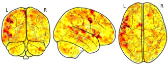
Collection description
The individual Brain Charting (IBC) Project is using high resolution fMRI to map 13 subjects that undergo a large number of tasks: the HCP tasks, the so-called ARCHI tasks, a specific language task, video watching, low-level visual stimulation etc. The native resolution of the data is 1.5mm isotropic. Their main value lies in the large number of contrasts probed, the level of detail and the high SNR per subject. This dataset is meant to provide the basis of a functional brain atlas. We upload here smoothed individual SPMs. The uploaded maps comprise session-specific and fixed effects across maps acquired with AP and PA phase encoding directions.
Note that Neurovault collection #4438 is a subset of that one. In the present collections, some details have been fixed, including mroe accurate and unique file naming.
Subject species
homo sapiens
Modality
fMRI-BOLD
Analysis level
single-subject
Cognitive paradigm (task)
synatcting and semantic fMRI task paradigm
Map type
Z
- N
Individual Brain Charting dataset extension, second release of...
- neurovault.org
niftiUpdated Feb 14, 2020+ more versionsShareFacebookTwitterEmailClick to copy linkLink copiedCite(2020). Individual Brain Charting dataset extension, second release of high-resolution fMRI data for cognitive mapping: sub-04_ses-03_task-rsvp_language_dir-pa_run-01_sentence-jabberwocky [Dataset]. http://identifiers.org/neurovault.image:364697niftiAvailable download formatsUnique identifierhttps://identifiers.org/neurovault.image:364697Dataset updatedFeb 14, 2020LicenseCC0 1.0 Universal Public Domain Dedicationhttps://creativecommons.org/publicdomain/zero/1.0/
License information was derived automaticallyDescription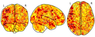
Collection description
The individual Brain Charting (IBC) Project is using high resolution fMRI to map 13 subjects that undergo a large number of tasks: the HCP tasks, the so-called ARCHI tasks, a specific language task, video watching, low-level visual stimulation etc. The native resolution of the data is 1.5mm isotropic. Their main value lies in the large number of contrasts probed, the level of detail and the high SNR per subject. This dataset is meant to provide the basis of a functional brain atlas. We upload here smoothed individual SPMs. The uploaded maps comprise session-specific and fixed effects across maps acquired with AP and PA phase encoding directions.
Note that Neurovault collection #4438 is a subset of that one. In the present collections, some details have been fixed, including mroe accurate and unique file naming.
Subject species
homo sapiens
Modality
fMRI-BOLD
Analysis level
single-subject
Cognitive paradigm (task)
synatcting and semantic fMRI task paradigm
Map type
Z
- N
Individual Brain Charting dataset extension, second release of...
- neurovault.org
niftiUpdated Feb 14, 2020ShareFacebookTwitterEmailClick to copy linkLink copiedCite(2020). Individual Brain Charting dataset extension, second release of high-resolution fMRI data for cognitive mapping: sub-05_ses-11_task-mtt_we_dir-pa_run-01_we_eastside_event [Dataset]. http://identifiers.org/neurovault.image:365090niftiAvailable download formatsUnique identifierhttps://identifiers.org/neurovault.image:365090Dataset updatedFeb 14, 2020LicenseCC0 1.0 Universal Public Domain Dedicationhttps://creativecommons.org/publicdomain/zero/1.0/
License information was derived automaticallyDescription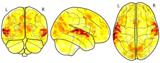
Collection description
The individual Brain Charting (IBC) Project is using high resolution fMRI to map 13 subjects that undergo a large number of tasks: the HCP tasks, the so-called ARCHI tasks, a specific language task, video watching, low-level visual stimulation etc. The native resolution of the data is 1.5mm isotropic. Their main value lies in the large number of contrasts probed, the level of detail and the high SNR per subject. This dataset is meant to provide the basis of a functional brain atlas. We upload here smoothed individual SPMs. The uploaded maps comprise session-specific and fixed effects across maps acquired with AP and PA phase encoding directions.
Note that Neurovault collection #4438 is a subset of that one. In the present collections, some details have been fixed, including mroe accurate and unique file naming.
Subject species
homo sapiens
Modality
fMRI-BOLD
Analysis level
single-subject
Cognitive paradigm (task)
Mental time travel task
Map type
Z
- N
Individual Brain Charting dataset extension, second release of...
- neurovault.org
niftiUpdated Feb 14, 2020+ more versionsShareFacebookTwitterEmailClick to copy linkLink copiedCite(2020). Individual Brain Charting dataset extension, second release of high-resolution fMRI data for cognitive mapping: sub-15_ses-15_task-mtt_sn_dir-pa_run-01_northside-southside_event [Dataset]. http://identifiers.org/neurovault.image:367942niftiAvailable download formatsUnique identifierhttps://identifiers.org/neurovault.image:367942Dataset updatedFeb 14, 2020LicenseCC0 1.0 Universal Public Domain Dedicationhttps://creativecommons.org/publicdomain/zero/1.0/
License information was derived automaticallyDescription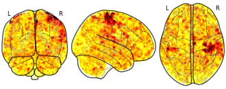
Collection description
The individual Brain Charting (IBC) Project is using high resolution fMRI to map 13 subjects that undergo a large number of tasks: the HCP tasks, the so-called ARCHI tasks, a specific language task, video watching, low-level visual stimulation etc. The native resolution of the data is 1.5mm isotropic. Their main value lies in the large number of contrasts probed, the level of detail and the high SNR per subject. This dataset is meant to provide the basis of a functional brain atlas. We upload here smoothed individual SPMs. The uploaded maps comprise session-specific and fixed effects across maps acquired with AP and PA phase encoding directions.
Note that Neurovault collection #4438 is a subset of that one. In the present collections, some details have been fixed, including mroe accurate and unique file naming.
Subject species
homo sapiens
Modality
fMRI-BOLD
Analysis level
single-subject
Cognitive paradigm (task)
Mental time travel task
Map type
Z
- N
Individual Brain Charting dataset extension, second release of...
- neurovault.org
niftiUpdated Feb 14, 2020ShareFacebookTwitterEmailClick to copy linkLink copiedCite(2020). Individual Brain Charting dataset extension, second release of high-resolution fMRI data for cognitive mapping: sub-01_ses-00_task-archi_social_dir-pa_false_belief_video [Dataset]. http://identifiers.org/neurovault.image:364114niftiAvailable download formatsUnique identifierhttps://identifiers.org/neurovault.image:364114Dataset updatedFeb 14, 2020LicenseCC0 1.0 Universal Public Domain Dedicationhttps://creativecommons.org/publicdomain/zero/1.0/
License information was derived automaticallyDescription
Collection description
The individual Brain Charting (IBC) Project is using high resolution fMRI to map 13 subjects that undergo a large number of tasks: the HCP tasks, the so-called ARCHI tasks, a specific language task, video watching, low-level visual stimulation etc. The native resolution of the data is 1.5mm isotropic. Their main value lies in the large number of contrasts probed, the level of detail and the high SNR per subject. This dataset is meant to provide the basis of a functional brain atlas. We upload here smoothed individual SPMs. The uploaded maps comprise session-specific and fixed effects across maps acquired with AP and PA phase encoding directions.
Note that Neurovault collection #4438 is a subset of that one. In the present collections, some details have been fixed, including mroe accurate and unique file naming.
Subject species
homo sapiens
Modality
fMRI-BOLD
Analysis level
single-subject
Cognitive paradigm (task)
Social localizer fMRI task paradigm
Map type
Z
- N
Individual Brain Charting dataset extension, second release of...
- neurovault.org
niftiUpdated Feb 14, 2020ShareFacebookTwitterEmailClick to copy linkLink copiedCite(2020). Individual Brain Charting dataset extension, second release of high-resolution fMRI data for cognitive mapping: sub-11_ses-19_task-enumeration_dir-pa_enumeration_linear [Dataset]. http://identifiers.org/neurovault.image:366708niftiAvailable download formatsUnique identifierhttps://identifiers.org/neurovault.image:366708Dataset updatedFeb 14, 2020LicenseCC0 1.0 Universal Public Domain Dedicationhttps://creativecommons.org/publicdomain/zero/1.0/
License information was derived automaticallyDescription
Collection description
The individual Brain Charting (IBC) Project is using high resolution fMRI to map 13 subjects that undergo a large number of tasks: the HCP tasks, the so-called ARCHI tasks, a specific language task, video watching, low-level visual stimulation etc. The native resolution of the data is 1.5mm isotropic. Their main value lies in the large number of contrasts probed, the level of detail and the high SNR per subject. This dataset is meant to provide the basis of a functional brain atlas. We upload here smoothed individual SPMs. The uploaded maps comprise session-specific and fixed effects across maps acquired with AP and PA phase encoding directions.
Note that Neurovault collection #4438 is a subset of that one. In the present collections, some details have been fixed, including mroe accurate and unique file naming.
Subject species
homo sapiens
Modality
fMRI-BOLD
Analysis level
single-subject
Cognitive paradigm (task)
Enumeration task
Map type
Z
- N
Individual Brain Charting dataset extension, second release of...
- neurovault.org
niftiUpdated Feb 14, 2020ShareFacebookTwitterEmailClick to copy linkLink copiedCite(2020). Individual Brain Charting dataset extension, second release of high-resolution fMRI data for cognitive mapping: sub-04_ses-12_task-mtt_sn_dir-pa_run-02_sn_average_event [Dataset]. http://identifiers.org/neurovault.image:364799niftiAvailable download formatsUnique identifierhttps://identifiers.org/neurovault.image:364799Dataset updatedFeb 14, 2020LicenseCC0 1.0 Universal Public Domain Dedicationhttps://creativecommons.org/publicdomain/zero/1.0/
License information was derived automaticallyDescription
Collection description
The individual Brain Charting (IBC) Project is using high resolution fMRI to map 13 subjects that undergo a large number of tasks: the HCP tasks, the so-called ARCHI tasks, a specific language task, video watching, low-level visual stimulation etc. The native resolution of the data is 1.5mm isotropic. Their main value lies in the large number of contrasts probed, the level of detail and the high SNR per subject. This dataset is meant to provide the basis of a functional brain atlas. We upload here smoothed individual SPMs. The uploaded maps comprise session-specific and fixed effects across maps acquired with AP and PA phase encoding directions.
Note that Neurovault collection #4438 is a subset of that one. In the present collections, some details have been fixed, including mroe accurate and unique file naming.
Subject species
homo sapiens
Modality
fMRI-BOLD
Analysis level
single-subject
Cognitive paradigm (task)
Mental time travel task
Map type
Z
- N
Individual Brain Charting dataset extension, second release of...
- neurovault.org
niftiUpdated Feb 14, 2020ShareFacebookTwitterEmailClick to copy linkLink copiedCite(2020). Individual Brain Charting dataset extension, second release of high-resolution fMRI data for cognitive mapping: sub-04_ses-15_task-preference_food_dir-pa_food_linear [Dataset]. http://identifiers.org/neurovault.image:364827niftiAvailable download formatsUnique identifierhttps://identifiers.org/neurovault.image:364827Dataset updatedFeb 14, 2020LicenseCC0 1.0 Universal Public Domain Dedicationhttps://creativecommons.org/publicdomain/zero/1.0/
License information was derived automaticallyDescription
Collection description
The individual Brain Charting (IBC) Project is using high resolution fMRI to map 13 subjects that undergo a large number of tasks: the HCP tasks, the so-called ARCHI tasks, a specific language task, video watching, low-level visual stimulation etc. The native resolution of the data is 1.5mm isotropic. Their main value lies in the large number of contrasts probed, the level of detail and the high SNR per subject. This dataset is meant to provide the basis of a functional brain atlas. We upload here smoothed individual SPMs. The uploaded maps comprise session-specific and fixed effects across maps acquired with AP and PA phase encoding directions.
Note that Neurovault collection #4438 is a subset of that one. In the present collections, some details have been fixed, including mroe accurate and unique file naming.
Subject species
homo sapiens
Modality
fMRI-BOLD
Analysis level
single-subject
Cognitive paradigm (task)
pleasantness rating task
Map type
Z
- N
Individual Brain Charting dataset extension, second release of...
- neurovault.org
niftiUpdated Feb 14, 2020ShareFacebookTwitterEmailClick to copy linkLink copiedCite(2020). Individual Brain Charting dataset extension, second release of high-resolution fMRI data for cognitive mapping: sub-04_ses-12_task-mtt_sn_dir-pa_run-02_sn_after-before_event [Dataset]. http://identifiers.org/neurovault.image:364823niftiAvailable download formatsUnique identifierhttps://identifiers.org/neurovault.image:364823Dataset updatedFeb 14, 2020LicenseCC0 1.0 Universal Public Domain Dedicationhttps://creativecommons.org/publicdomain/zero/1.0/
License information was derived automaticallyDescription
Collection description
The individual Brain Charting (IBC) Project is using high resolution fMRI to map 13 subjects that undergo a large number of tasks: the HCP tasks, the so-called ARCHI tasks, a specific language task, video watching, low-level visual stimulation etc. The native resolution of the data is 1.5mm isotropic. Their main value lies in the large number of contrasts probed, the level of detail and the high SNR per subject. This dataset is meant to provide the basis of a functional brain atlas. We upload here smoothed individual SPMs. The uploaded maps comprise session-specific and fixed effects across maps acquired with AP and PA phase encoding directions.
Note that Neurovault collection #4438 is a subset of that one. In the present collections, some details have been fixed, including mroe accurate and unique file naming.
Subject species
homo sapiens
Modality
fMRI-BOLD
Analysis level
single-subject
Cognitive paradigm (task)
Mental time travel task
Map type
Z
FacebookTwitterHistorical Map & Chart Collection of NOAA's Nautical Charts, Hydrographic Surveys, Topographic Surveys, Geodetic Surveys, City Plans, and Civil War Battle Maps Starting from the mid 1700's
The Historical Map and Chart Collection of the Office of Coast Survey contains over 35000 historical maps and charts from the mid 1700s up through the 2020s, including the final cancelled editions of NOAA's raster charts. These images are available for viewing or download through the image catalog at https://historicalcharts.noaa.gov/. The Collection includes some of the nation's earliest nautical charts, hydrographic surveys, topographic surveys, bathymetric maps, annual reports, coast pilots, geodetic surveys, city plans, and Civil War battle maps. The Collection is a rich primary historical archive and a testament to the artistry of copper plate engraving technology of the nineteenth and twentieth centuries. Notable offerings include maps of Vancouver's explorations, the "Wilkes Atlas" of the U.S. Whistler's Anacapa Island chart, an extensive Civil War collection, a large scale topographic series of Washington, D.C., city plans, the reengraving of the famous 1792 L'Enfant and Ellicott plan for Washington D.C., and many artistic perspective sketches that were once an integral part of hydrographic surveys and published charts.