- o
Scenes partitioning and annotations of Super Mario Bros. levels.
- explore.openaire.eu
Updated Mar 24, 2025 Share
Share Facebook
 Twitter
 EmailClick to copy linkLink copiedCiteYann Harel; Hugo Delhaye; Basile Pinsard; Pierre Bellec (2025). Scenes partitioning and annotations of Super Mario Bros. levels. [Dataset]. http://doi.org/10.5281/zenodo.14847565Unique identifierhttps://doi.org/10.5281/zenodo.14847565Dataset updatedMar 24, 2025AuthorsYann Harel; Hugo Delhaye; Basile Pinsard; Pierre BellecDescription
Resources used to split Super Mario Bros. levels into succcessive "scenes" Each level map was first obtained from NesMaps and added to the mario_scenes_manual_annotations.pdf file. Using the stable-retro GUI, we obtained the X positions corresponding to the start and end of each scene. Then for each scenes, we identified game design patterns as described in Dahlskog & Togelius, 2012. We aggregated all these informations in the scenes_mastersheet.tsv file. Note : Underwater and Castle levels were ignored in our analysis because they have a slightly different gameplay than the regular level, and make use of different game design patterns. Bonus zones and water sections are annotated as such, but their patterns weren't identified. The scenes mastersheet This TSV file contains informations related to all the scenes identified in Super Mario Bros. levels. It contains one row per scene, 3 columns to identify the scene, an Entry and Exit point columns, and one columns per pattern. These columns contain the following information : - World : The world ID, an integer between 1 and 8.- Level : The level ID, an integer between 1 and 3.- Scene : The scene ID, an integer.- Entry point : The X position corresponding to the beginning of the scene. An integer.- Exit point : The X position corresponding to the ending of the scene. An integer. Design patterns (from Dahlskog & Togelius 2012). The values can be 0 (absence of the corresponding pattern) or 1 (presence of the corresponding pattern) : - Enemy : A single enemy- 2-Horde : Two enemies together- 3-Horde : Three enemies together- 4-Horde : Four enemies together- Roof : Enemies underneath a hanging platform making Mario bounce in the ceiling- Gap : Single gap in the ground/platform- Multiple gaps : More than one gap with fixed platforms in between- Variable gaps : Gap and platform width is variable- Gap enemy : Enemies in the air above gaps- Pillar gap : Pillar (pipes or blocks) are placed on platforms between gaps- Valley : A valley created by using vertically stacked blocks or pipes but without Piranha plant(s)- Pipe valley : A valley with pipes and Piranha plant(s)- Empty valley : A valley without enemies- Enemy valley : A valley with enemies- Roof valley : A valley with enemies and a roof making Mario bounce in the ceiling- 2-Path : A hanging platform allowing Mario to choose different paths- 3-Path : 2 hanging platforms allowing Mario to choose different paths- Risk/Reward : A multiple path where one path have a reward and a gap or enemy making it risky to go for the reward- Stair up : A stair going up- Stair down : A stair going down- Empty stair valley : A valley between a stair up and a stair down without enemies- Enemy stair valley : A valley between a stair up and a stair down with enemies- Gap stair valley : A valley between a stair up and a stair down with gap in the middle We added several patterns in order to annotate key sections of the level : - Reward : Rewards without immediate danger- Moving platform : Platform moving vertically or horizontally- Flagpole : End of the level- Beginning : Beginning of the level- Bonus zone : Hidden zone without enemies- Waterworld : A special hidden zone with Waterworld gameplay
Public Rights of Way
- mario-lancashirecounty.hub.arcgis.com
- mariotest-lancashirecc3.hub.arcgis.com
- +1more
Updated Feb 27, 2024+ more versionsShareFacebookTwitterEmailClick to copy linkLink copiedCiteLancashire County Council (2024). Public Rights of Way [Dataset]. https://mario-lancashirecounty.hub.arcgis.com/items/1f514b522aa94e3fac39a13d4a2d795cDataset updatedFeb 27, 2024Area coveredDescriptionThe public rights of way information shown on this system has been copied from the Definitive Map of Public Rights Of Way, the legal record of public rights of way - footpaths, bridleways and byways open to all traffic. The digitised rights of way information is updated regularly to record changes to the rights of way network. The map has been produced to assist you in your visits to the Countryside. It is not a legal record. Some public rights of way may exist which are not shown on the Definitive Map.
Mario Company profile with phone,email, buyers, suppliers, price, export...
- volza.com
csvUpdated Jun 30, 2025ShareFacebookTwitterEmailClick to copy linkLink copiedCiteVolza FZ LLC (2025). Mario Company profile with phone,email, buyers, suppliers, price, export import shipments. [Dataset]. https://www.volza.com/company-profile/mario-33497228csvAvailable download formatsDataset updatedJun 30, 2025Dataset provided byVolzaAuthorsVolza FZ LLCLicenseAttribution 4.0 (CC BY 4.0)https://creativecommons.org/licenses/by/4.0/
License information was derived automaticallyTime period covered2014 - Sep 30, 2021Variables measuredCount of exporters, Count of importers, Sum of export value, Sum of import value, Count of export shipments, Count of import shipmentsDescriptionCredit report of Mario contains unique and detailed export import market intelligence with it's phone, email, Linkedin and details of each import and export shipment like product, quantity, price, buyer, supplier names, country and date of shipment.
- N
aristocles's temporary collection: Mario
- neurovault.org
niftiUpdated Jan 27, 2016ShareFacebookTwitterEmailClick to copy linkLink copiedCite(2016). aristocles's temporary collection: Mario [Dataset]. http://identifiers.org/neurovault.image:8765niftiAvailable download formatsUnique identifierhttps://identifiers.org/neurovault.image:8765Dataset updatedJan 27, 2016LicenseCC0 1.0 Universal Public Domain Dedicationhttps://creativecommons.org/publicdomain/zero/1.0/
License information was derived automaticallyDescription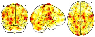
Collection description
None
Subject species
homo sapiens
Modality
fMRI-BOLD
Cognitive paradigm (task)
instrumental learning task
Map type
F
Mario De La Guardia Company profile with phone,email, buyers, suppliers,...
- volza.com
csvUpdated Jun 24, 2025ShareFacebookTwitterEmailClick to copy linkLink copiedCiteVolza FZ LLC (2025). Mario De La Guardia Company profile with phone,email, buyers, suppliers, price, export import shipments. [Dataset]. https://www.volza.com/company-profile/mario-de-la-guardia-21338223/csvAvailable download formatsDataset updatedJun 24, 2025Dataset provided byVolzaAuthorsVolza FZ LLCLicenseAttribution 4.0 (CC BY 4.0)https://creativecommons.org/licenses/by/4.0/
License information was derived automaticallyTime period covered2014 - Sep 30, 2021Variables measuredCount of exporters, Count of importers, Sum of export value, Sum of import value, Count of export shipments, Count of import shipmentsDescriptionCredit report of Mario De La Guardia contains unique and detailed export import market intelligence with it's phone, email, Linkedin and details of each import and export shipment like product, quantity, price, buyer, supplier names, country and date of shipment.
- a
Bus Stops
- mario-lancashirecounty.hub.arcgis.com
- mariotest-lancashirecc3.hub.arcgis.com
- +1more
Updated Feb 27, 2024ShareFacebookTwitterEmailClick to copy linkLink copiedCiteLancashire County Council (2024). Bus Stops [Dataset]. https://mario-lancashirecounty.hub.arcgis.com/maps/lancashirecounty::bus-stopsDataset updatedFeb 27, 2024Dataset authored and provided byLancashire County CouncilArea coveredDescriptionLocation of bus stops. This data covers bus stops in Lancashire, Blackburn with Darwen, and Blackpool (including Blackpool tram stops).
- a
Multiple Deprivation Index
- mario-lancashirecounty.hub.arcgis.com
- mariotest-lancashirecc3.hub.arcgis.com
- +1more
Updated Feb 27, 2024ShareFacebookTwitterEmailClick to copy linkLink copiedCiteLancashire County Council (2024). Multiple Deprivation Index [Dataset]. https://mario-lancashirecounty.hub.arcgis.com/datasets/multiple-deprivation-indexDataset updatedFeb 27, 2024Dataset authored and provided byLancashire County CouncilArea coveredDescriptionCensus Lower Super Output Area boundaries as of 2011, with indices of multiple deprivation statistics (2019)
- Z
Maps of solar wind plasma precipitation onto Mercury's surface: a...
- data.niaid.nih.gov
- zenodo.org
Updated Sep 2, 2023ShareFacebookTwitterEmailClick to copy linkLink copiedCiteD'Amore, Mario (2023). Maps of solar wind plasma precipitation onto Mercury's surface: a geographical perspective [Dataset]. https://data.niaid.nih.gov/resources?id=zenodo_7927372Dataset updatedSep 2, 2023Dataset provided byCalifano, Francesco
Savin, Daniel
D'Amore, Mario
Domingue, Deborah
Henri, Pierre
Jensen, Elizabeth
Lindsay, Simon
Raines, Jim
Lavorenti, Federico
Aizawa, SaeLicenseAttribution 4.0 (CC BY 4.0)https://creativecommons.org/licenses/by/4.0/
License information was derived automaticallyDescriptionData Archive to accompany: "Maps of solar wind plasma precipitation onto Mercury’s surface: a geographical perspective." Federico Lavorenti, Elizabeth A. Jensen, Sae Aizawa, Francesco Califano, Mario D’Amore, Deborah Domingue, Pierre Henri, Simon Lindsay, Jim M. Raines, and Daniel Wolf Savin. Submitted 2023 May to Planetary Science Journal.
The files contained in this archive comprise the values shown in Figures 3 & 5.
- a
Assault with Less Serious Injury
- mario-lancashirecounty.hub.arcgis.com
- mariotest-lancashirecc3.hub.arcgis.com
- +1more
Updated Feb 27, 2024+ more versionsShareFacebookTwitterEmailClick to copy linkLink copiedCiteLancashire County Council (2024). Assault with Less Serious Injury [Dataset]. https://mario-lancashirecounty.hub.arcgis.com/maps/lancashirecounty::assault-with-less-serious-injuryDataset updatedFeb 27, 2024Dataset authored and provided byLancashire County CouncilArea coveredDescriptionAssault with Less Serious Injury offences for the period 01/06/2024 to 31/05/2025 by ward, shown as the rate per 1000 population.
- a
Serious Violent Crime
- mariotest-lancashirecc3.hub.arcgis.com
- hub.arcgis.com
- +1more
Updated Feb 27, 2024+ more versionsShareFacebookTwitterEmailClick to copy linkLink copiedCiteLancashire County Council (2024). Serious Violent Crime [Dataset]. https://mariotest-lancashirecc3.hub.arcgis.com/datasets/lancashirecounty::serious-violent-crimeDataset updatedFeb 27, 2024Dataset authored and provided byLancashire County CouncilArea coveredDescriptionSerious Violent Crime offences for the period 01/06/2024 to 31/05/2025 by ward, shown as rate per 1000 population
- a
Hospitals
- mario-lancashirecounty.hub.arcgis.com
- hub.arcgis.com
- +1more
Updated Feb 27, 2024ShareFacebookTwitterEmailClick to copy linkLink copiedCiteLancashire County Council (2024). Hospitals [Dataset]. https://mario-lancashirecounty.hub.arcgis.com/datasets/hospitalsDataset updatedFeb 27, 2024Dataset authored and provided byLancashire County CouncilArea coveredDescriptionLocations of hospitals in Lancashire.
- d
Textural soil maps, Colombia, 0 - 100 cm
- search.dataone.org
- portal.edirepository.org
Updated Sep 6, 2022+ more versionsShareFacebookTwitterEmailClick to copy linkLink copiedCiteViviana Marcela Varón-Ramírez; Gustavo A. Araujo-Carrillo; Mario Guevara (2022). Textural soil maps, Colombia, 0 - 100 cm [Dataset]. https://search.dataone.org/view/https%3A%2F%2Fpasta.lternet.edu%2Fpackage%2Fmetadata%2Feml%2Fedi%2F972%2F3Dataset updatedSep 6, 2022Dataset provided byEnvironmental Data InitiativeAuthorsViviana Marcela Varón-Ramírez; Gustavo A. Araujo-Carrillo; Mario GuevaraTime period coveredFeb 1, 1970 - Nov 30, 2009Area coveredVariables measuredNo_layer, Name_layer, DescriptionDescriptionThese are the first texture maps of Colombia, obtained from national and global digital soil mapping products. The maps were developed at five standard depths (0-5, 5-15, 15-30, 30-60, and 60-100 cm) and standardized with Additive log-ratio (ALR) transformation. The maps were harmonized at 1 square km of spatial resolution. The data packages include the following set maps: texture maps obtained through the Ensemble Machine Learning (EML) algorithms called landmap and MACHISPLIN; texture maps obtained from SoilGrids platform; residual maps of the texture of the algorithms referenced above; and finally texture maps obtained through spatial ensemble technique.
Data from: Mapping Research Data at the University of Bologna: Dataset
- zenodo.org
- paperswithcode.com
csv, pdfUpdated Mar 26, 2025+ more versionsShareFacebookTwitterEmailClick to copy linkLink copiedCiteSara Coppini; Sara Coppini; Giulia Caldoni; Giulia Caldoni; Bianca Gualandi; Bianca Gualandi; Mario Marino; Mario Marino (2025). Mapping Research Data at the University of Bologna: Dataset [Dataset]. http://doi.org/10.5281/zenodo.14234555csv, pdfAvailable download formatsUnique identifierhttps://doi.org/10.5281/zenodo.14234555Dataset updatedMar 26, 2025AuthorsSara Coppini; Sara Coppini; Giulia Caldoni; Giulia Caldoni; Bianca Gualandi; Bianca Gualandi; Mario Marino; Mario MarinoLicenseCC0 1.0 Universal Public Domain Dedicationhttps://creativecommons.org/publicdomain/zero/1.0/
License information was derived automaticallyTime period coveredDec 12, 2024Area coveredBolognaDescriptionThis dataset was developed within an analysis of research data generated and managed within the University of Bologna, with respect to the differences and commonalities between disciplines and potential challenges for institutional data support services and infrastructures. We are primarily mapping the type (e.g., image), content (e.g., scan of a manuscript) and format (e.g., .tiff) of managed data, thus sustaining the value of FAIR data as granular resources.
The analysis is based on data management plans (DMPs) produced by grantees of Horizon Europe and Horizon 2020 funding who are affiliated to the University of Bologna and are either project coordinators or partners in charge of the DMP. We are including in the study only the DMPs shared with us between May 2022 (when the data stewards team was created) and October 2023.In short, we have selected variables of interest to be headers of a table that is progressively filled with information garnered through a close reading of the DMPs.Computational analysis (R version 4.2.2) on the collected data produce graphs showing composition, relationship (bar graphs, pie charts and alluvial/sankey charts) and incidences (waterfall graph) of the different variables. Code for computational analysis on this data is "Mapping Reseach Data at the University of Bologna: Code" and it is also deposited on Zenodo (see Related Works).Mario Eimuth Company profile with phone,email, buyers, suppliers, price,...
- volza.com
csvUpdated Jun 19, 2025ShareFacebookTwitterEmailClick to copy linkLink copiedCiteVolza FZ LLC (2025). Mario Eimuth Company profile with phone,email, buyers, suppliers, price, export import shipments. [Dataset]. https://www.volza.com/company-profile/mario-eimuth-21943876csvAvailable download formatsDataset updatedJun 19, 2025Dataset provided byVolzaAuthorsVolza FZ LLCLicenseAttribution 4.0 (CC BY 4.0)https://creativecommons.org/licenses/by/4.0/
License information was derived automaticallyTime period covered2014 - Sep 30, 2021Variables measuredCount of exporters, Count of importers, Sum of export value, Sum of import value, Count of export shipments, Count of import shipmentsDescriptionCredit report of Mario Eimuth contains unique and detailed export import market intelligence with it's phone, email, Linkedin and details of each import and export shipment like product, quantity, price, buyer, supplier names, country and date of shipment.
- z
[[Deprecated]] DIGITAL SOIL TEXTURE MAPS OF ARGENTINA
- zenodo.org
- data.niaid.nih.gov
tiffUpdated Jul 17, 2024ShareFacebookTwitterEmailClick to copy linkLink copiedCiteGuillermo A. Schulz; Darío M. Rodríguez; Marcos E. Angelini; Marcos E. Angelini; Lucas M. Moretti; Guillermo F. Olmedo; Guillermo F. Olmedo; Leonardo M. Tenti Vuegen; Juan C. Colazo; Mario Guevara Santamaria; Guillermo A. Schulz; Darío M. Rodríguez; Lucas M. Moretti; Leonardo M. Tenti Vuegen; Juan C. Colazo; Mario Guevara Santamaria (2024). [[Deprecated]] DIGITAL SOIL TEXTURE MAPS OF ARGENTINA [Dataset]. http://doi.org/10.5281/zenodo.5851411tiffAvailable download formatsUnique identifierhttps://doi.org/10.5281/zenodo.5851411Dataset updatedJul 17, 2024Dataset provided bySpringerAuthorsGuillermo A. Schulz; Darío M. Rodríguez; Marcos E. Angelini; Marcos E. Angelini; Lucas M. Moretti; Guillermo F. Olmedo; Guillermo F. Olmedo; Leonardo M. Tenti Vuegen; Juan C. Colazo; Mario Guevara Santamaria; Guillermo A. Schulz; Darío M. Rodríguez; Lucas M. Moretti; Leonardo M. Tenti Vuegen; Juan C. Colazo; Mario Guevara SantamariaLicenseAttribution 4.0 (CC BY 4.0)https://creativecommons.org/licenses/by/4.0/
License information was derived automaticallyDescriptionA new version has been uploaded by Guillermo Schulz.
Dataset: Multi-level network dataset of social-ecological interdependencies...
- zenodo.org
- data.niaid.nih.gov
bin, csv, pdf, zipUpdated Jul 16, 2024ShareFacebookTwitterEmailClick to copy linkLink copiedCiteMartin Nicola Huber; Martin Nicola Huber; Mario Angst; Mario Angst; Manuel Fischer; Manuel Fischer (2024). Dataset: Multi-level network dataset of social-ecological interdependencies in ten Swiss wetlands based on qualitative interviews and quantitative surveys [Dataset]. http://doi.org/10.5281/zenodo.6907175zip, bin, csv, pdfAvailable download formatsUnique identifierhttps://doi.org/10.5281/zenodo.6907175Dataset updatedJul 16, 2024AuthorsMartin Nicola Huber; Martin Nicola Huber; Mario Angst; Mario Angst; Manuel Fischer; Manuel FischerLicenseAttribution 4.0 (CC BY 4.0)https://creativecommons.org/licenses/by/4.0/
License information was derived automaticallyArea coveredSwitzerlandDescriptionThe dataset originated from quantitative online surveys and qualitative expert interviews with organizational actors relevant to the governance of ten Swiss wetlands from 2019 till 2021. Multi-level networks represent the wetlands governance for each of the ten cases. The collaboration networks of actors form the first level of the multi-level networks and are connected to multiple other network levels that account for the social and ecological systems those actors are active in. 521 actors relevant to the management of the ten wetlands are included in the collaboration networks; quantitative survey data exists for 71% of them. A unique feature of the collaboration networks is that it differentiates between positive and negative forms of collaboration specified based on actors' activity areas. Therefore, the data describes not only if actors collaborate but also how and where actors collaborate. Further additional two-mode networks (actor participation in forums and involvement in other regions outside the case area) are elicited in the survey and connected to the collaboration network. Finally, the dataset also contains data on ecological system interdependencies in the form of conceptual maps derived from 34 expert interviews (3-4 experts per case).
Road Works
- mario-lancashirecounty.hub.arcgis.com
- arc-gis-hub-home-arcgishub.hub.arcgis.com
- +2more
Updated Feb 27, 2024ShareFacebookTwitterEmailClick to copy linkLink copiedCiteLancashire County Council (2024). Road Works [Dataset]. https://mario-lancashirecounty.hub.arcgis.com/datasets/road-worksDataset updatedFeb 27, 2024Area coveredDescriptionRoad works, both in progress and planned, in Lancashire.
Mario Jpireslda Company profile with phone,email, buyers, suppliers, price,...
- volza.com
csvUpdated Jan 7, 2025ShareFacebookTwitterEmailClick to copy linkLink copiedCiteVolza FZ LLC (2025). Mario Jpireslda Company profile with phone,email, buyers, suppliers, price, export import shipments. [Dataset]. https://www.volza.com/company-profile/mario-jpireslda-19026550csvAvailable download formatsDataset updatedJan 7, 2025Dataset provided byVolzaAuthorsVolza FZ LLCLicenseAttribution 4.0 (CC BY 4.0)https://creativecommons.org/licenses/by/4.0/
License information was derived automaticallyTime period covered2014 - Sep 30, 2021Variables measuredCount of exporters, Count of importers, Sum of export value, Sum of import value, Count of export shipments, Count of import shipmentsDescriptionCredit report of Mario Jpireslda contains unique and detailed export import market intelligence with it's phone, email, Linkedin and details of each import and export shipment like product, quantity, price, buyer, supplier names, country and date of shipment.
Soil moisture and GPP trends across the Avocado "Green Gold" Belt in central...
- zenodo.org
- data.niaid.nih.gov
zipUpdated May 13, 2023ShareFacebookTwitterEmailClick to copy linkLink copiedCiteAylin Barreras; Aylin Barreras; Mario Guevara; Sebastián Gutiérrez; Mario Guevara; Sebastián Gutiérrez (2023). Soil moisture and GPP trends across the Avocado "Green Gold" Belt in central Mexico (2001-2018) [Dataset]. http://doi.org/10.5281/zenodo.7926166zipAvailable download formatsUnique identifierhttps://doi.org/10.5281/zenodo.7926166Dataset updatedMay 13, 2023AuthorsAylin Barreras; Aylin Barreras; Mario Guevara; Sebastián Gutiérrez; Mario Guevara; Sebastián GutiérrezLicenseAttribution 4.0 (CC BY 4.0)https://creativecommons.org/licenses/by/4.0/
License information was derived automaticallyDescriptionData processing in RStudio for soil moisture and Gross Primary Productivity trends across the Avocado “Green Gold” Belt in central Mexico (2001-2018).
Schools Geographical Priority Areas
- mariotest-lancashirecc3.hub.arcgis.com
- mario-lancashirecounty.hub.arcgis.com
- +1more
Updated Feb 27, 2024ShareFacebookTwitterEmailClick to copy linkLink copiedCiteLancashire County Council (2024). Schools Geographical Priority Areas [Dataset]. https://mariotest-lancashirecc3.hub.arcgis.com/datasets/lancashirecounty::schools-geographical-priority-areasDataset updatedFeb 27, 2024Area coveredDescriptionGeographical Priority Areas (GPAs) for Primary and Secondary Schools where their admissions policy includes priority areas.
FacebookTwitterScenes partitioning and annotations of Super Mario Bros. levels.
Resources used to split Super Mario Bros. levels into succcessive "scenes" Each level map was first obtained from NesMaps and added to the mario_scenes_manual_annotations.pdf file. Using the stable-retro GUI, we obtained the X positions corresponding to the start and end of each scene. Then for each scenes, we identified game design patterns as described in Dahlskog & Togelius, 2012. We aggregated all these informations in the scenes_mastersheet.tsv file. Note : Underwater and Castle levels were ignored in our analysis because they have a slightly different gameplay than the regular level, and make use of different game design patterns. Bonus zones and water sections are annotated as such, but their patterns weren't identified. The scenes mastersheet This TSV file contains informations related to all the scenes identified in Super Mario Bros. levels. It contains one row per scene, 3 columns to identify the scene, an Entry and Exit point columns, and one columns per pattern. These columns contain the following information : - World : The world ID, an integer between 1 and 8.- Level : The level ID, an integer between 1 and 3.- Scene : The scene ID, an integer.- Entry point : The X position corresponding to the beginning of the scene. An integer.- Exit point : The X position corresponding to the ending of the scene. An integer. Design patterns (from Dahlskog & Togelius 2012). The values can be 0 (absence of the corresponding pattern) or 1 (presence of the corresponding pattern) : - Enemy : A single enemy- 2-Horde : Two enemies together- 3-Horde : Three enemies together- 4-Horde : Four enemies together- Roof : Enemies underneath a hanging platform making Mario bounce in the ceiling- Gap : Single gap in the ground/platform- Multiple gaps : More than one gap with fixed platforms in between- Variable gaps : Gap and platform width is variable- Gap enemy : Enemies in the air above gaps- Pillar gap : Pillar (pipes or blocks) are placed on platforms between gaps- Valley : A valley created by using vertically stacked blocks or pipes but without Piranha plant(s)- Pipe valley : A valley with pipes and Piranha plant(s)- Empty valley : A valley without enemies- Enemy valley : A valley with enemies- Roof valley : A valley with enemies and a roof making Mario bounce in the ceiling- 2-Path : A hanging platform allowing Mario to choose different paths- 3-Path : 2 hanging platforms allowing Mario to choose different paths- Risk/Reward : A multiple path where one path have a reward and a gap or enemy making it risky to go for the reward- Stair up : A stair going up- Stair down : A stair going down- Empty stair valley : A valley between a stair up and a stair down without enemies- Enemy stair valley : A valley between a stair up and a stair down with enemies- Gap stair valley : A valley between a stair up and a stair down with gap in the middle We added several patterns in order to annotate key sections of the level : - Reward : Rewards without immediate danger- Moving platform : Platform moving vertically or horizontally- Flagpole : End of the level- Beginning : Beginning of the level- Bonus zone : Hidden zone without enemies- Waterworld : A special hidden zone with Waterworld gameplay